National Parks
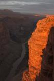
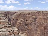
- Grand Canyon National Park - Tuweep Area
- The Tuweep area is probably as remote as you can get in Grand Canyon National Park while still being close to a road (unpaved). The canyon is much narrower than in the more popular areas, but almost just as deep - the rim towers 3000 vertical feed over the Colorado River, and at places you could probably do one wrong step and not see ground again until you're in the river.
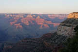
- Grand Canyon National Park
- The Grand Canyon area was turned into a national monument in 1908, and became a national park in 1919. The main viewpoints are along the North Rim and South Rim. Elevation varies from around 9,000 feet (North Rim) to 2,000 feet (canyon floor). Both rims can be accessed via paved roads, with the North Rim being subject to winter closures due to snow. The canyon floor can be accessed by a number of trails, the most popular probably being "Bright Angel Trail" which descends from 6,860 feet down to 2,400 feet, thus losing 4,460 feet over the course of 7.7 miles.

- Petrified Forest National Park
- This area protects a large petrified forest - fossil wood where all the organic materials have been replaced with minerals - and some of the most colourful badlands I've seen.
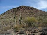
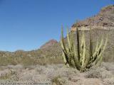
- Saguaro National Park
- Saguaro National Park is located close to Tucson in Southern Arizona, and is named after the Saguaro cactus, which abounds in the area.
[Top]National Monuments

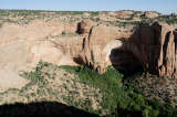
- Canyon de Chelly National Monument
- Canyon de Chelly is located on Navajo land. The main canyon can be overlooked from both the South Rim and the North Rim, and there is only one trail into the canyon that people can use without hiring a guide. I had to limit my visit to the South Rim, unfortunately, but did manage to cover all the important viewpoints.

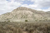
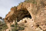
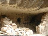
- Casa Grande Ruins National Monument
- Casa Grande (Spanish for "big house") is a small number of Hohokam structures that were built in the 13th century and abandoned by the 15th. The Hohokam farmed the Gila Valley in the early 13th century. Unfortunately, the biggest one is now protected by a distinctively ugly metal roof constructed in 1932.

- Chiricahua National Monument
- The primary feature of Chiricahua National Monument, located in southern Arizona, are its colourful rock spires, which are volcanic in origin. The somewhat unusual name "Chiricahua" allegedly is based on an Opata word meaning "wild turkey" - these used to be abundant in the area but were almost extinguished by the 1950s.


[Top]National Forests
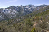

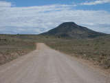
- Tonto National Forest
- Tonto National Forest, the fifth-largest national forest in the United States, is home to Apache Trail, a scenic road (partially unpaved) that travels through the Superstition Mountains and along Canyon and Apache Lakes. Due to its proximity to Phoenix, this area gets considerable visitation, and as such the roads can be busier than one would expect from the surrounding land that looks very much like wilderness.